Engineering Department
Geoscience & Data Interpretation
Timely and reliable processing, integration and interpretation of your exploration and production data — designed to manage, interpret and deliver information when and where it is needed.
Operations support and data services
Our interpretations provide the reservoir and rock properties that are key to characterising and understanding lithology, porosity, permeability, formation thickness, water saturation, pressure and rock mechanical properties — enabling clients to make decisions about long-term exploration and development strategies.
Geoscientists and petro-technical engineers support clients from pre-job through real-time acquisition to final delivery of results, confirming that the data and interpretation products meet their needs. Because E&P data must often be processed, interpreted and delivered quickly to support decisions affecting well-site operations, we provide services on a turnaround time basis.
Disciplines
Seven interpretation disciplines under one roof.
The engineering department applies SeaLand technology to support wireline and D&M data interpretation, maximising the information drawn from well and field measurements.
01Geophysics
Mapping subsurface structure to illustrate underlying structures, the spatial distribution of rock units, and features such as faults, folds and intrusive rocks. We cover survey planning — seismic, electromagnetic methods, borehole geophysics and gravity techniques — through quality control, processing and model building. Gravity and magnetic methods add to seismic rather than replacing it: responsive to lateral variations in rock properties, they are well suited to detecting steep discontinuities such as faults. Identifying aquifers with major water supply potential can also be studied using geophysical and geological measurements — we assess aquifer potential and well salinisation mechanisms with SeaLand's simulation and visualisation capability, in close cooperation with the Water Resources commission.
02Petrophysics interpretation
A petrophysical data set commonly contains overlapping sub-populations influenced by different geological factors, so we analyse it not only by rock type but also for the effects of alteration, weathering, metamorphism and strain, and variables such as porosity and stratigraphy. The result evaluates the rock properties that determine reserves and producibility, informing where to complete, how to stimulate and where to drill next.
03Geology interpretation
Borehole imaging probes and vertical seismic profiling are now common in boreholes drilled for oil, mineral exploration, geotechnical investigation and groundwater programmes. Applications include geotechnical site investigation where slope stability and rock support are key, tunnelling, structural geology, casing integrity and mineral exploration. Geological, geophysical and geochemical methods together with drilling technology also improve the effectiveness and productivity of mineral exploration — we gather and interpret the data required in other exploration fields such as copper and metal-enriched ore deposits, using both surface and subsurface equipment.
04Geomechanics & technical services
Predict drilling risks in the first well and maximise recovery from mature assets. One of our major project types anticipates the properties of the sea floor and the engineering structures to be installed on it — pipelines, platforms and drilling rigs — using geophysical and geotechnical study.
05Well placement engineering
By performing advanced interpretation on real-time LWD and MWD data, the engineering department provides advanced well trajectory design and geosteering services to improve well placement.
06Borehole seismic
New technology in data gathering, processing and interpretation of borehole seismic and vertical seismic profiling (VSP), where we act as a market leader in this domain.
07Borehole reservoir & production
PSP production logging, pre- and post-acid, with interpretation giving the production contribution of each reservoir, evaluation of the acid job, detection of possible water entry points and of any cross-flow during a shut-in survey. Sampling and interpretation give reservoir pressure versus depth, fluid mobility, samples for lab analysis, PVT and vertical permeability.
Seismic services
Processing, interpretation and reservoir characterisation.
Seismic data processing
- Conventional seismic processing
- Advanced technique of velocity analysis (SCVA)
- Pre-stack time migration (PSTM)
- Pre-stack depth migration (PSDM)
Seismic interpretation
- Time horizons and faults interpretation
- Mapping
- Complex structure interpretation
- Salt interpretation
- Depth conversion
- Advanced interpretation of subtle faults
- Multi survey / vintage interpretation
Reservoir characterisation
- Seismic facies analysis
- Seismic attribute study for reservoir property prediction
- Post-stack seismic inversion
- Pre-stack simultaneous seismic inversion
- Seismic AVO
- Seismic geo-hazard analysis and pore pressure prediction
- Spectral decomposition and subtle structural interpretation
Modelling
Static, dynamic and petroleum system modelling.
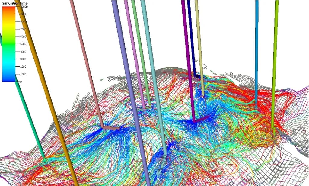
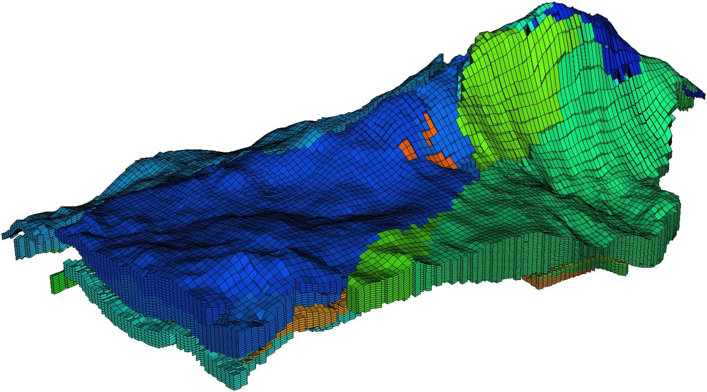
We hold the software, hardware and people for reservoir static and dynamic modelling in both carbonate and sandstone reservoirs. Petroleum system and basin modelling is a critical key to exploration success and risk reduction, and we can also run the laboratory tests required for the geochemical analysis behind it — with particular experience in Central Iran and offshore Iran. For geomechanics we provide well-bore stability analysis across Iranian fields, helping clients mitigate drilling hazards and improve productivity.
Static & dynamic modelling
- Advanced facies modelling (MPS)
- Reservoir structural modelling
- Reservoir property modelling
- Fracture modelling
- Volume calculation
- Uncertainty analysis
- Dynamic reservoir modelling
- Master development plan preparation
Petroleum system modelling
- 1D, 2D and 3D petroleum system modelling
- 2D and 3D structural reconstruction and back stripping
- Play to prospect evaluation
- Prospect ranking
- Prospect charge, reservoir and seal risk assessment
- Hydrocarbon tracing
- Geochemical laboratory tests
- Exploration block assessment
- Structural geology and tectonic assessment
Geomechanics
- 1D MEM and wellbore stability analysis
- 1D sand control and management
- Safe mud window design
- 3D in-situ stress modelling
- Well trajectory design and optimisation
Selected projects
- South Pars — reservoir model updatingPetroPars
- Cheshmeh Khosh — 3D seismic processing (PSDM)ICOFC
- Dehloran — 3D seismic processing (PSTM)ICOFC
Software and computing resources
Interpretation is carried out on industry-standard platforms, listed by discipline below. Software and computing resources are not limited to this list and are provisioned case by case according to project need — including cluster capacity for seismic processing, which is run from our premises outside Iran.
- Geology
- Interactive Petrophysics (IP), Geolog, GeoFrame Geology Module (Geology Office, Boreview, Image), Petrel
- Geophysics
- GeoFrame (Boreseis / VSP, Charisma, IESX), Petrel E&P platform, Fugro-Jason Geoscience Workbench
- Petrophysics
- Interactive Petrophysics, Geolog, GeoFrame (ElanPlus, Preplus, Ressum, LithoToolkit)
- Modelling
- PetroMod 1D/2D/3D suite, Dynel structural reconstruction, PMWIN 3D groundwater modelling
- Geomechanics
- Petrel, Pore Pressure Window, RiskTRAK, DrillMAP, GeoFrame, Caliban, Hosana, BorStress
- Drilling & well placement
- Drilling Office, RTGS, Petrel
- Reservoir engineering
- Eclipse 100 / 300 / 500, Frontsim, Petrel
Next step
Ready to plan your next operation?
Share the well, the field and the scope. Our operations and engineering teams will scope the right package and crew.